
What data do RGA diagnoses use?
RGA diagnoses rely on three categories of data: geological (official mapping available on Géorisques, clay type, formation thickness), climatic (drought history, SWI soil moisture indices, climate projections), and geotechnical (plasticity tests, Atterberg limits, swelling index, water content). This information is cross-referenced through hydro-geotechnical models to produce a reliable assessment.
Geological data
The Géorisques platform provides several sources of information:
- •Shrink-swell hazard map: built from 50,000 borings and 1:50,000 geological maps, it classifies the territory into four risk levels
- •Lithological maps: identification of clay types (smectite, illite, kaolinite) and their spatial distribution
- •Subsurface database (BSS): over 800,000 referenced boreholes, available online to learn the local stratigraphy
Climate data
Météo-France and INRAE provide key indicators:
- •Soil Wetness Index (SWI): satellite measurement of surface water content, updated daily
- •Drought history: Cat-Nat (natural disaster) category events since 1989
- •Potential evapotranspiration (PET): climate water balance by weather station
Geotechnical data
Standardized laboratory tests include:
- •Atterberg limits (NF P94-051): determine soil plasticity (liquid limit LL, plastic limit PL, plasticity index PI)
- •Free swell test: measures the volumetric change amplitude during water saturation
- •Methylene blue value (MBV): quantifies clay activity and swelling potential
- •Grain size and mineralogical analysis: clay fraction, mineral identification by X-ray diffraction
TerraStab has developed a hydro-geotechnical model derived from research work that integrates these three data blocks to produce a personalized risk score. This model accounts for soil water kinetics, local climate history and building specifics to anticipate future movement.
How to interpret your risk score?
The RGA risk score is generally presented as four levels (low, medium, high, very high) or a numerical scale. Low risk means predictable movement stays below 1 cm and only requires monitoring. High or very high risk implies potential movement above 3 cm, warranting prevention or stabilization measures. Interpretation should always be contextualized based on the building's condition and planned projects.
| Risk level | Predictable movement | Recommendations |
|---|---|---|
| Low | < 1 cm | Regular monitoring, compliance with standard construction rules (DTU 13.1) |
| Medium | 1 to 2 cm | Reinforced foundations, perimeter drainage, vegetation management |
| High | 2 to 4 cm | Deep or semi-deep foundations, reinforced tie-beams, or soil hydro-stabilization |
| Very high | > 4 cm | Active stabilization solutions (moisture regulation, micropiles), continuous monitoring |
In practice, several factors modulate score interpretation:
- •Construction type: a recent home built to seismic standards will be more resilient than an older building with shallow foundations
- •Surrounding vegetation: trees with extensive root systems can worsen risk by 1 to 2 levels
- •Claims history: land that has already experienced damage carries a higher probability of recurrence
- •Extension or renovation projects: any building modification must account for RGA-related constraints
A risk score is not fixed. Climate change, changes in vegetation, or landscaping work can shift the exposure level. It is recommended to reassess risk every 5 to 10 years, especially after an exceptional drought episode.
When should an RGA diagnosis be carried out?
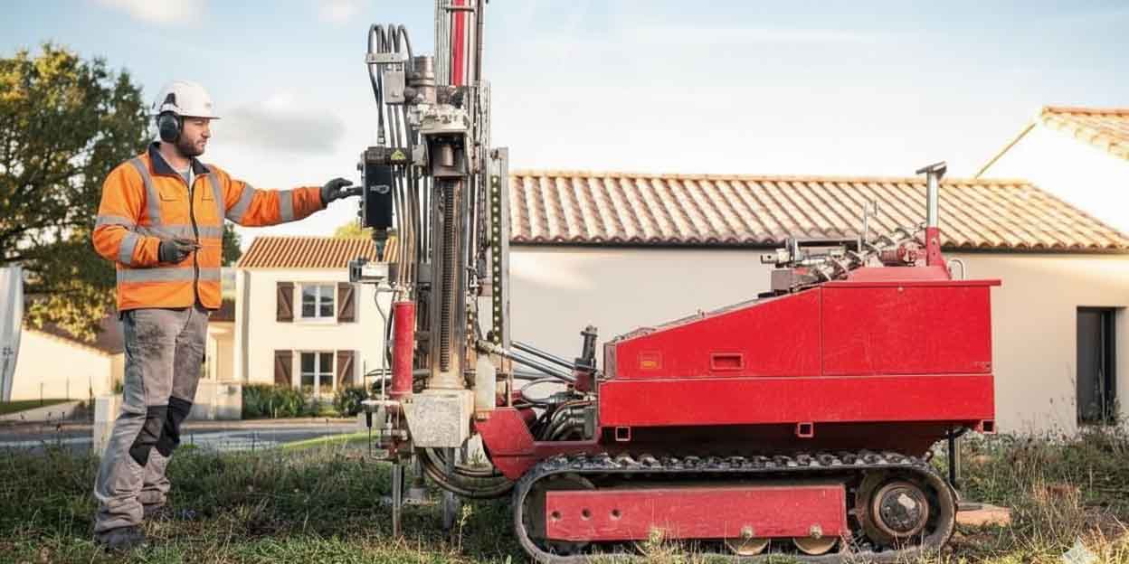
An RGA diagnosis is recommended in several situations: before buying land or a home in a medium-to-high hazard zone, in the presence of worsening cracks, before extension or elevation works, or as part of an insurance claim. It serves as a reference document to guide construction or corrective choices.
Key moments to carry out a diagnosis include:
- Before purchase: check the land's exposure and anticipate construction or compliance costs
- In case of cracks: establish an objective assessment and identify the cause (RGA, settlement, construction defect)
- Before works: make sure an extension or renovation won't weaken the existing building
- For a Cat-Nat claim: document the damage and its link to a recognized drought event
- After an exceptional drought episode: assess how the risk has evolved and anticipate future cycles
According to a study by the AQC (French Construction Quality Agency), 85% of owners who had a diagnosis performed before building in a risk zone avoided costly claims, compared to only 40% of those who built without a prior study.
Solutions suited to your risk score: the role of hydro-stabilization
The RGA diagnosis helps identify the solution best suited to the context. Since 2015, hydro-stabilization has joined the range of possible responses, offering an alternative to micropiles for medium-to-high hazard zones with early-stage damage. The choice depends on the risk score, the building's condition, and the available budget.
Guidance table based on risk score:
| Risk score | Building condition | Possible solutions |
|---|---|---|
| Low | No damage | Monitoring, prevention (vegetation, drainage) |
| Medium | Fine cracks (< 2 mm) | Hydro-stabilization, reinforced drainage, active monitoring |
| High | Active cracks (2-5 mm) | Hydro-stabilization (if shallow foundations), screw piles, localized micropiles |
| Very high | Large cracks, subsidence | Micropiles, underpinning, combined approach |
TerraStab's hydro-stabilization, based on unsaturated soil mechanics principles documented in international scientific literature, is particularly effective for homes in medium-to-high hazard zones, especially when foundations are shallow. It works by stabilizing soil moisture through a network of connected sensors and an automated irrigation system, reducing clay movement by up to 85-90%. Its controlled cost (€1,000 to €8,000) and non-invasive nature make it a relevant alternative to heavy underpinning works.
However, the TerraStab solution isn't reserved solely for the most critical cases. Even in low-hazard areas, or when the diagnosis is uncertain, autonomous soil monitoring can provide valuable information to anticipate the appearance of cracks. And for the highest-risk situations, a full installation may become the most suitable response.
For very high scores or severely degraded buildings, micropiles often remain necessary. In some cases, a combined approach may be considered: localized micropiles at critical corners plus overall hydro-stabilization to prevent the damage from spreading.
Frequently asked questions
Is the diagnosis mandatory?
Since January 2020, a preliminary geotechnical study (G1) is mandatory for any sale of buildable land in a medium or high hazard zone. For existing buildings, the diagnosis isn't mandatory but is strongly recommended in case of cracks or planned works.
Read the ELAN regulationCan I do it myself?
You can check the hazard map on Géorisques for free to get a first level of information. However, a complete diagnosis requires geotechnical expertise (borings, lab tests, interpretation) and must be carried out by a qualified engineering firm. A self-assessment may underestimate the actual risk.
Are the official Géorisques maps reliable everywhere?
Official hazard maps are established nationwide with a precision of 1:50,000. They provide an excellent assessment baseline, but have limitations in geological transition zones or for small plots of land. An on-site geotechnical study provides greater precision suited to the local context.
How much does an RGA diagnosis cost?
The cost varies depending on the scope of the study: a preliminary G1 study costs between €800 and €1,500, a G2 design study (with in-depth borings) between €2,000 and €5,000. These amounts should be weighed against RGA damage repair costs, which average €15,000 to €50,000 per claim.
Does the diagnosis guarantee no future problems?
No. A diagnosis assesses a probabilistic risk at a given moment, based on available data. Climate change, vegetation changes or land modifications can alter this risk. However, a well-conducted diagnosis helps guide preventive solutions that considerably reduce the probability of a claim.
Discover the solutions suited to your scoreIn summary
An RGA diagnosis is a decision-support tool that combines geology, climate and building analysis to produce a reliable risk assessment. Whether before a purchase, in the presence of cracks, or before works, it helps anticipate and guide toward suitable solutions. Official mapping data, climate data and geotechnical tests form a solid scientific foundation for understanding and managing clay shrink-swell subsidence.
Ready to assess your RGA risk?
Get a personalized diagnosis in just a few minutes.
References
[1] Géorisques (2023). Clay shrink-swell hazard map. Official portal. https://www.georisques.gouv.fr
[4] Géorisques (2023). Preventing RGA risk. Technical resources. https://www.georisques.gouv.fr
[5] ELAN Law (2018). Article 68 – Preliminary geotechnical study in medium or high hazard zones. Légifrance. https://www.ecologie.gouv.fr
[6] AFNOR (2018). NF P94-051: Determination of Atterberg limits. French geotechnical standard. https://www.afnor.org
How is shrink-swell risk assessed?
Assessing RGA risk rests on three pillars: the official geological mapping that identifies soil type, climate analysis that measures drought exposure, and a geotechnical study of the site that characterizes local sensitivity. These combined data points produce a risk score that anticipates the probability and intensity of ground movement.
In practice, a complete diagnosis follows a standardized multi-step methodology:
A well-conducted RGA diagnosis significantly reduces claim risk by pointing toward preventive or corrective solutions suited to the context.
Since January 1, 2020, a preliminary geotechnical study (G1 study) is mandatory before any sale of buildable land located in a medium or high hazard zone (ELAN law, article 68). This obligation aims to inform the buyer and prevent damage.